How to Contribute to GMRS Repeater Coverage Maps
How to Contribute to GMRS Repeater Coverage Maps
The Importance of Community Mapping Efforts
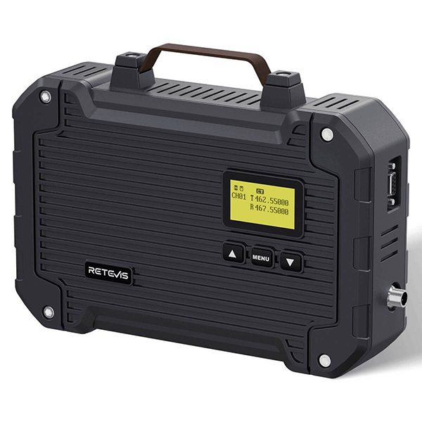
Accurate GMRS repeater coverage maps benefit the entire radio community, helping users understand service areas and identify gaps. Whether you're using the 25W RT97L with its IP66 waterproof rating or another system, your field data can improve these shared resources. Here's how to effectively contribute to coverage mapping projects.
Getting Started with Coverage Mapping
Essential Equipment
-
Reliable GMRS radio (like the RT97L with uniform signal distribution)
-
GPS-enabled device (smartphone or dedicated GPS unit)
-
Signal strength recording tools (apps or paper logs)
-
Camera (to document antenna installations)
4 Step Contribution Process
1. Prepare Your RT97L System
-
Ensure proper 25W output calibration
-
Verify IP66 seals for weatherproof operation
-
Confirm antenna is correctly installed
-
Test uniform signal distribution pattern
2. Choose Your Mapping Method
A. Manual Drive/Walk Testing
-
Plan routes that radiate from repeater
-
Record signal strength at regular intervals
-
Note GPS coordinates for each measurement
-
Document terrain and obstructions
B. Automated Mobile Apps
-
RF Signal Tracker
-
OpenSignal
-
Network Signal Info Pro
-
GMRS-specific mapping tools
3. Collect Key Data Points
-
Signal strength (RSSI) readings
-
GPS coordinates with timestamps
-
Audio quality assessments
-
Terrain and obstruction notes
-
Weather conditions during testing
4. Submit Your Findings
Where to Contribute:
-
MyGMRS.com coverage maps
-
RepeaterBook community data
-
Local GMRS club databases
-
Regional emergency communication groups
The RT97L Advantage for Accurate Mapping
This repeater excels for coverage mapping because:
-
Consistent 25W output provides reliable baseline data
-
IP66 waterproof construction allows all-weather testing
-
Uniform signal distribution creates predictable patterns
-
Stable performance ensures measurement consistency
- RT97L
Best Practices for Quality Data
-
Standardize your testing methodology
-
Test at different times of day/year
-
Document antenna details (height/type/gain)
-
Note unusual interference sources
-
Share negative results (dead zones matter too)
Advanced Contribution Opportunities
For dedicated mappers:
-
Create seasonal coverage comparisons
-
Develop terrain-specific propagation models
-
Map multi-repeater handoff zones
-
Document mobile coverage patterns
Maintaining Your Mapping Equipment
For ongoing accuracy:
-
Regularly verify RT97L power output
-
Check IP66 seals before wet weather
-
Recalibrate measurement devices
-
Update antenna system documentation
Conclusion: Building Better Maps Together
Your contributions using equipment like the 25W RT97L with IP66 waterproof rating help create more accurate, useful coverage maps for the entire GMRS community. By following these methods and sharing your findings, you're supporting better communications for everyone.